

The geography of Kenya is diverse. The country has a coastline on the Indian Ocean, which contains swamps of East African mangroves, coconut palm trees and some patches of tropical rainforest.
Kenya‘s inland consists of broad plains and many hills. Central and Western regions are characterized by the Great Rift Valley home to two of Africa‘s highest mountains, Mount Kenya and Mount Elgon.
Kakamega Forest, situated in Western Kenya is relic of an East African rainforest. Much larger is Mau Forest, the largest indigenous montane forest in East Africa.
The climate of Kenya varies from tropical along coast to arid in the interior. Kenya weather is generally sunny year-round with the main rainy seasons being from March to May and from November to December.
Geography of Kenya – General Facts
Location:
East Africa, boarding South Sudan (317 km), Ethiopia (867 km), Somalia (684 km), Tanzania (775 km) and Uganda (814 km). Total land boundaries: 3,457 km. Coastline: 536 km.
Geographic coordinates:
1 00 N, 38 00 E
Area:
The country occupies an area of 580,367 square kilometers, 49th in the world, slightly more than twice the size of Nevada. Total land area: 569,140 square kilometers. Total water area: 11,227 square kilometers.
Lowest point:
Indian Ocean 0 m.
Highest point:
Peak Batian, Mount Kenya, 5,199 m (second highest summit in Africa after peak Kibo, Mount Kilimanjaro, 5,895 m).
Maritime claims:
Territorial sea: 12 nautical miles. Exclusive economic zone: 200 nautical miles. Continental shelf: 200 meters depth or to the depth of exploitation.
Terrain:
Low plains rise to central highlands that are, in turn, bisected by the Great Rift Valley; fertile plateau in west.
Natural resources:
Limestone, gemstones, salt, soda ash, fluorspar, gypsum, zinc, diatomite, wildlife and hydroelectric power.
Land use:
9.48% of the land is arable. Permanent crops occupy 1.12% of the land. Other uses make up 89.4% (2011). Irrigated land occupies 1,032 sq km (2010).
Total renewable water resources:
30.7 cu km (2011)
Freshwater withdrawal (domestic/industrial/agricultural):
Total: 2.74 cu km/yr (17%/4%/79%) Per capita: 72.96 cu m/yr (2003)
Main rivers:
The two main rivers are the Tana and the Galana. However, the Ewaso Ng’iro is a very important river supplying water from Mount Kenya to the northern part of the country.
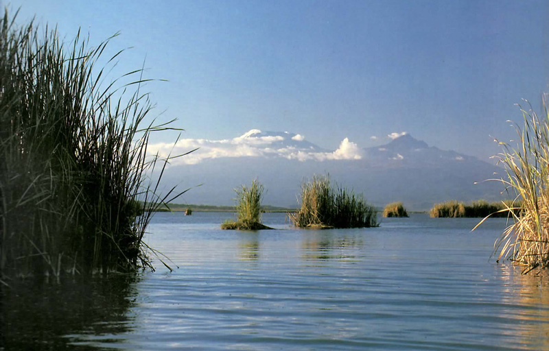
Main lakes:
Lake Victoria and Lake Turkana.
Natural hazards:
Recurring drought and flooding during rainy seasons. Limited volcanic activity; the Barrier, south of Lake Turkana, elevation 1,032 m, last erupted in 1921; South Island is the only other historically active volcano.
Environmental issues:
Water pollution from urban and industrial wastes; degradation of water quality from increased use of pesticides and fertilizers; water hyacinth infestation in Lake Victoria; deforestation; soil erosion; desertification; poaching.
Environmental international agreements:
Kenya is party to: Biodiversity, Climate Change, Climate Change-Kyoto Protocol, Desertification, Endangered Species, Hazardous Wastes, Law of the Sea, Marine Dumping, Marine Life Conservation, Ozone Layer Protection, Ship Pollution, Wetlands and Whaling. None of the aforementioned agreements have been signed, but not ratified.
Geography of Kenya note:
The Kenyan Highlands comprise one of the most successful agricultural production regions in Africa; glaciers are found on Mt Kenya; unique physiography supports abundant and varied wildlife of scientific and economic value.
Other Pages That May Interest You
Climate of Kenya – Seven Climatic Zones
Kenya Weather Conditions and Forecast
Demographics of Kenya
Mountains in Kenya
Map of Kenya
Tourism in Kenya
Economy of Kenya
Will Go To Travel Directory
Return from Geography of Kenya to the Homepage
Kenya > Kenya Travel Guide > Geography of Kenya